

Edbo
-
Posts
136 -
Joined
-
Last visited
Content Type
Profiles
Forums
Gallery
Events
Store
Posts posted by Edbo
-
-
OK...I get what you mean about the side walls now. I am actually planning to do that anyway. No way would I try to bend metal around that bottom bend.
One more question, I see that the hat channel is available in different gauges, what would you recommend?
Some of the structure is already hat channel and it's pretty heavy but I don't know what gauge it is.
I would use use at least a 20 gauge so that your roof screws will have some meat to hold to. 18 gauge would be even better
-
Edbo I like your first suggestion. So you are saying that the steel roofing will flex vertically enough to fit to that radius? If so, this sounds like the best solution. You mention 28 gauge for the horizontal suggestion but what gauge would you recommend for the vertical orientation with the hat's channel on 24" centers? Also, can you explain what you mean by running it differently at the very top of the side walls?
If if your going to use hats channel then 30 gauge will work and it is more forgiving as making the radius.
on the sides I would recommend running metal horizontal from the ground up and over that sharp turn on the sides at the top then put my metal roof on and let it hang over that sort of like a soffit.
-
I need some advice from somebody in the business. I am agonizing over this and have swung back and forth for 3 weeks between tearing what I have down and starting from scratch or trying to put a roof on the frame that I have.
Those of you who have attended my maintenance day have seen my 30' x 60' greenhouse that is no longer used for a greenhouse. It has a solid rolled U type galvanized structure with a double ply poly top and sides that are kept inflated by a fan.
After more than 10 years, the top is starting to fail and I need to figure out a way to roof it or tear it down and put up a metal building. The problem is that due to the light weight of the plastic top, there isn't a lot of structure. I've seen it with 3 ft. of snow on it so it is fairly strong. The "rafters" are galvanized steel and on 6' centers. The side walls are only 4' and the peak is 14'. The roof is curved. I'll include a picture here to give you some kind of idea.
So, I've thought about adding some horizontal supports running between the 6' center rafters and then decking and shingling it but I don't know if that's a good idea or not. I'm basically looking for the most economical way to roof this thing without having to redo it every few years.
Any suggestions?
http://www.venturerider.org/forum/attachment.php?attachmentid=111635
Im in commercial construction here in Alabama and I’ve seen this done before. You can do it one of two ways. One is to put what they call Hats channel running the length of the building screwed to the persons that are there about every 2ft, it’s light and doesn’t add much weight then you can put metal on top of that and yes it will bend to fit that curve. Will have to do run it different at the very top of the side walls but can make it work.
The other way is to run your metal with the ribs running horizontal, start at the bottom and work your way up so that the water runs down from over the other. You will need to use 28 gauge metal to span that 6’ or you can run the Hats channel under it for support.

-
Going down there next week in cage with family have house on beach anything to do cheaply. Thanks in advance. Local diners with good comfort food, 3hr day trips or such.
My my wife and I visit gulf shores often. Used to own condo there before a hurricane wiped it off the beach.
One place to eat is called Bahama Bobs, take a right at the tee where the hang out is about a mile on the left. Small place but food is excellent. Another place but is expensive is called Louisiana Lagnapie, Very up scale but food is great. If your in Pensacola area in evening you must eat at this placed called Maquire’s it’s an iris pub with some of the best food and an unusual atmosphere. Again an experience you will always remember.
Visiting the naval museum is a very memorable time that you will never forget, try to put that into schedule. If you would like you can go out to Fort Morgan and catch the ferry over mobile bay to dauphin island, that’s a fun trip.
There may be more things I think of if so I’ll let you know. Please let us know what adventures you go on for others that may want to visit the most beautiful beach’s.
-
Here ya go Edbo and anyone else who may be interested.. Tip reads thru Edbo's questions concerning being a passenger on this new one and in this vid,, she does her best to elaborate on the answers.. Keep in mind,, her answers are her own opinion and we dont necessarily agree to the answers thereof.. She's her own person that Tip (I LOVE her for that).. Hope this helps someone out there in some small way...
Thank you you for the time you took to answer these questions. I hope it helps others to see this because what you said about everybody has a different riding style but this gives us an idea of what the bike would be like for passenger. You where very helpful to me and my bride in what you shared. Thank you Tip and Cowpuc for the valuable insight you give to the riding community not only with this topic but also just to be able to see the country with your videos while you travel. Thank you again for sharing this with us.
-
Really good question.. Of course Her and I talked a lot about this and I could give ya some cheap shots at what I can remember she said BUT - instead of doing that I think I will interview her and stick up a vid of her answers.. Tip aint one to pull no punches,, she and I talked about the "heat" issue and, comparing to her experiences on my Harleys (she spent a LOT of time on my Shovel and other newer ones) and on demoing the Indians - her thoughts on this one really surprised me... She also brought up some points about the rider backrest I hadnt thought of - also wind buffeting from shield up and down ,,,,, no detail here,, will do an interview for ya Ed.. Got any ??'s ya want me to include? Anyone else got ??'s.. Be glad to run em by her in the interview!!
Some some questions that would help is, how hard/easy is it to get on or off of, do you feel enclosed or is there ample room to slid around a little in your seat, how far away are you from your riding buddy, is the seat comfortable, or is it hard, can you see over your riding buddy's head or do you have to look around him to see, can you sit back and relax, did you feel heat from the engine. That's all I can think of right now. Thanks for the info that you will be providing.
-
What did Tip think of the ride, was it comfortable, did she have plenty of room? Just some thoughts from the brides perspective please.
-
Here is a interesting read on the new Venture you might be interested in.
http://www.motorcyclistonline.com/2018-yamaha-star-venture-first-look-review
I thought it interesting about the engine oil cooler that is built into the frame. I wonder how well that works to keep engine heat down.
-
Edbo - I have NO idea how I missed this but I did!! I have been looking and searching - trying to figure out where we were when we found those border towns meeting each other - Maccaysville and Copper Hill! It was SOOOOO awesome up there.. Anyway - doing a little research here trying to find a picture about Sturgis to share with another member who was just talking about riding a Canyon out in Sturgis and BINGO - I discover your post,,, checked it out and guess what? Looks like YOU NAILED IT BROTHER!! THANK YOU!! Tip and I were talking about maybe swinging down that way very very soon - perhaps as soon as this summer on our way west!! That is some AWESOME riding down there in that area - definitely out classes The Dragon IMHO.. Anyway,, thanks again Edbo
Now back to looking for those photos..
Puc
i thought about this several times why you didn't respond I thought maybe this wasn't the area you were talking about. Glad I could help out. I really enjoy reading about your trips and hope someday I can ride out west and enjoy Gods country, but right now I'm enjoying gods country here in the south. North Georgia and North Carolina have some great roads to ride but Tennessee and south Kentucky has some great roads also to ride. If your ever coming back down into Tennessee let me know I know of a road that I have rode several times and still yet to meet a motorcycle on it. I hope no one finds it but I will let you in on the little secret. It's definitely way more fun than the dragon IMHO.
Glad your feeling better, get out and ride that will put a smile on your face and heal your body and soul.
-
There is an APP that's called Glympse that you can send someone your current location and also they can follow your travels down the road for a set time limit . Very usefull when out and about and trying to meet up with someone. They can see exactly where your at and at what speed your traveling.
-
I'm not on face book myself but I wanted to responded to this thread by saying, when I get a ride together with my riding friends I always remind them that there is to be no "complaining" and no talking "politics". All my friends are of them same opinion about politics but it just seems that it gets everyone so riled up that it makes my blood pressure go up so I make that rule so we can focus on the reason we are here together. That it is for the RIDE, the scenery, the wind in the face and the good times we have as friends. Some times along the way I might have to remind them of the rules. But it's all in good fun and so far we've never had anyone get mad. I feel I have good friends to ride with, just like here on this site there are good friends to bond with even though I may not meet anyone in person it's still home here on this site. Thanks to all that post and bring joy to so many others. And remember we are here for the RIDE.
-
Hey guys, so we are trying to get ready for this trip. I use to have about 3 different sites you could poke in your info where your going from-to dates and it would give you a forecast along your route. Now it seems they have all discontinued this. Weather channel dont have it anymore, Wunderground, or intellicast. What the heck are you folks using? It is nice to plug in info and at least have a half way guess of what to take a week or so out to get things ready to pack. Not wait till day of to pack.
I just go go to the weather page like intellicast or weather bug and type in the city and look at the 10 day forecast for that area.
-
Starting to get itchy. Our trip to NC is getting much closer. Whoo hoo about a week out. Sure hope it is cooler in the Cashiers, Highlands area when we go. Looking forward to some cooler weather (I hope)
I was in that area just this past weekend, doing what I call the water fall ride. Saw some great falls and the weather was already getting cooler there compared to down here in Alabama. Hope you have a great time on your adventure.
-
You could have just tied it on to the back and pulled it behind you......
Now that would have been a funny sight to see. If I could go fast enough I might could have flown back home.
-
690 miles between Gadsden, Alabama to somewhere up in Michigan along Hwy 127.
Does anyone have any experience? I've heard of it but never done it.
Yes I admit it, I've been known to kill time checking out yard, garage and estate sales. Not that I'm interested in bargains on baby clothes it's more about stumbling across some rare treasure or barn find.
Thinking about checking it out this year August 4th through 7th. The route is supposed to be scenic roads. Thought I might start in Alabama take a leisurely drive checking it out and see how far North I got.
Any thoughts please share.
i took my wife to this yard sale one year, but we did it on the motorcycle. Sure saved me a lot of money because she was only able to buy small stuff. She wanted to buy a used parachute but it was to big to fit in saddle bags:banana:
-
So does 32 stay paved from I40 to US-321? Do you know?
I have ridden this 32 you speak of. Let me tell you it is so much more fun to ride than the Tail of the Dragon. The reason most people don't ride it is because it does turn into a dirt road. If you get on it coming from Gatlinburg it has great pavement and some very nice curves for 11 miles then turns into a gravel road for another 1.5 miles and it is also just as curvey. I rode it coming off of I40 going to Gatlinburg but it was a planned ride knowing that it is gravel. If you want to ride it do it just turn around when you get to the gravel, it has a place you can turn around. I would ride that road any day instead of the dragon.
-
Where is the closest starting point of the Blue Ridge Parkway to Gatlinburg? Right now we are going North out of Gatlinburg to Little Cove Road, connect to 321 to Foothills Parkway to Chillohowee and get on 129 West to 72, 411, and take 360 to Cherohala Skyway. Take that to Robbinsville, NC. Take 129 North to the Moonshiner 28 I hear so much about. Take Moonshiner 28 to 74. Take 74 to 19. Take 19 into Cherokee and 441 back up to Gatlinburg? Sound like that will work? Criticize me....do whatever. I have never ridden this far south. I have been married and divorced twice and its about time that I go on a vacation that means something with the woman I should have found 2 marriages ago! Any advice to make this trip memorable is so very much appreciated.
This route that you have listed here will work perfectly for you. The mileage may not be a lot but it will take all day to do this ride but it will be worth it. Once you get into Robbinsville you can always change your route if needed to make it back over the mountain to Gatlinburg before dark. Don't want to drive over mountain after dark. You will enjoy riding this area no matter which road your on. Just remember all the roads people are telling you to ride are all good riding roads, but their is no way to hit them all on one trip so you enjoy what you have planned and ride the rest on another day.
-
Hello is anyone out there that can slap me in the face with a simple to do list for loading a route from Garmin Base Camp onto my Nuvi 2555?
It took me a while, but I planned the route on the computer, but I am not having any success in transferring it onto/into my GPS.
I was able to plan a route directly on my old GPS, but not on this one so I did it on Garmin Base Camp, but I can not save it on my GPS.
Any advice, smart comments, jokes, humiliation is welcome. I laugh at my self often for getting stumped by computer stuff. If I didn't laugh I would get so _ucking mad.
Thanks
I use use base camp for all my trips, base camp is not user friendly it took me awhile to figure out how to use it. So what I do is make sure your GPS is plugged into computer when you are using base camp so that it is using the maps that is on the GPS. Then I use waypoints, place flags or waypoints on the roads that I want to ride, then I click on create route. Drag your waypoints from the column on the left onto your route planner, drag them in the order from start to finish. Once the route is created go up to your menu and select send route to GPS. This is the basic information it may be more complicated than this for you but hope it gives you an idea of how. I use base camp on my IMac but I know the menus are different on PCs. If you have more questions please feel free to ask me and I will do what I can to help. Hope it works for you. Base camp could be a great program but its not.
-
Been there done that. She will be alright, but it is hard to let them grow up.
-
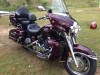
Congratulations on your new toy. I have looked those in that pretty blue color. Haven't pulled trigger yet. A hope you enjoy the new ride as much as you did the venture.
-
Try one of these.......Neighbor did a demo the other day. He said that 19 mph isn't no lie. Went down the road from one piece to another. he said they are nice....
http://altoz.com/media/1196/xc_k-1153_web.png
Looks like a 3rd generation in the making.
-
I hope everyone understands that this thread was started wayyyy back in 2007. I just had to bring it back up because the same ones posting back then are the ones still posting on it now. So funny, it is addictive though.
-
I found this thread and I have to agree , there are some people on here that are addicted to this site, me being one of them.
-
If only we could get $100.00 bill turn into $12,000 then I wouldn't complain. But it never seems to turn out in my favor.


New "to me" '06...
in Watering Hole
Posted
For sure the prettiest color of them all, and your right about that pillow seat. Have fun on your new toy.